Top-Down Perspective Map
- Model
- Nano Banana Pro
- Image
- 848 × 1248 px
Prompt
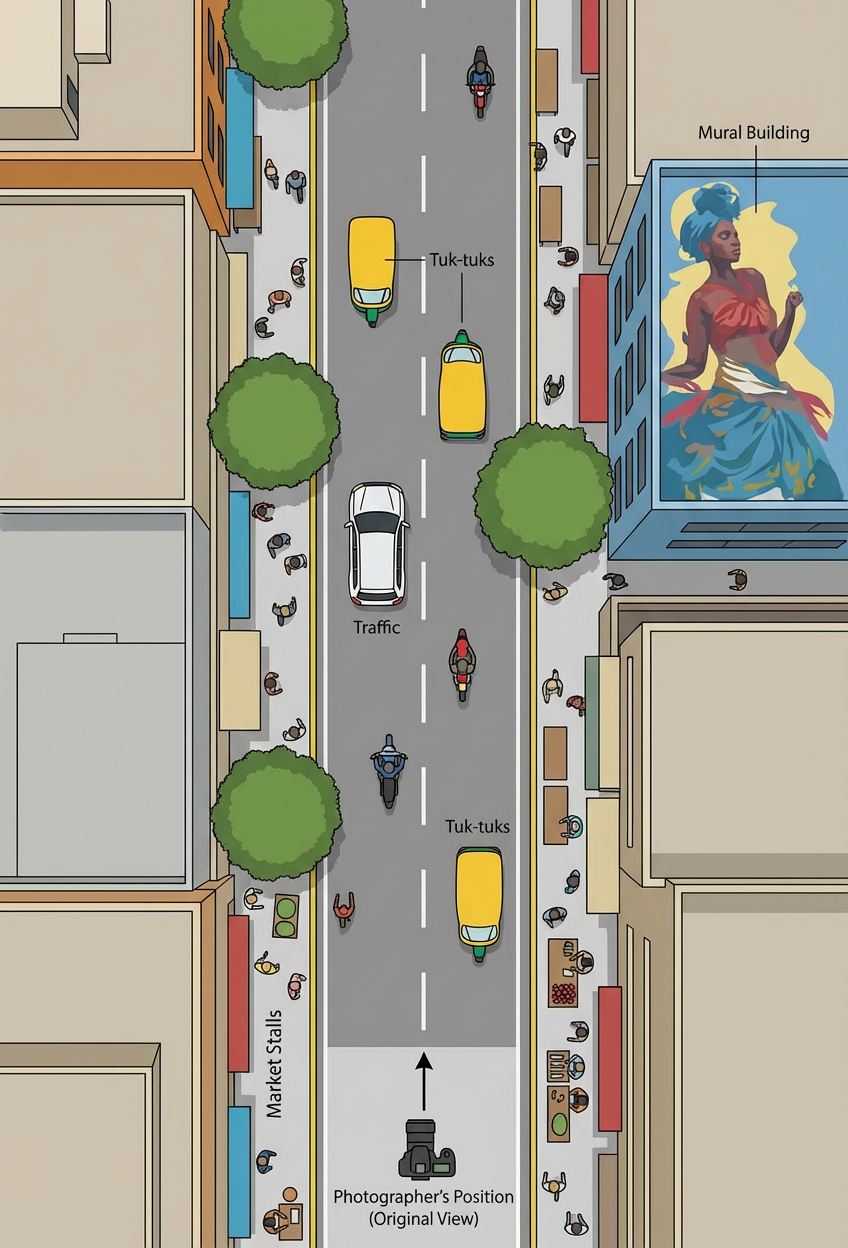
Convert the original photo into a top-down (bird’s-eye) view while preserving the spatial layout and relative positions of all key elements. Reconstruct the scene as if viewed from directly above, simplifying details where necessary but maintaining recognizable structure. Clearly mark the photographer’s position with a distinct icon or symbol, indicating the original camera angle and direction. Use clean, minimal visuals with subtle annotations to ensure clarity and easy interpretation
Any aspect ratio
Overview
Transforming ordinary photographs into top-down perspectives has never been easier with our innovative AI Image Editor template, designed to convert your shots into clear, comprehensive maps. This tool simplifies complex scenes, making it ideal for projects that require bird’s-eye views, like architectural planning or video game level design.
What It Does
This template uses the powerful nano-banana-pro model to convert your photos into a top-down view, maintaining spatial layouts while simplifying intricate details. It marks the original photographer's position, adding clarity and context. With AI Image Editor capabilities, you can achieve clean and minimalistic visuals that are easily interpretable.
Who It's For
Whether you're a game designer, fantasy world builder, or urban planner, this tool is perfect for anyone needing detailed overhead maps. It's also beneficial for architects and engineers who require visual clarity from bird’s-eye perspectives for better communication of structures and layouts.
Summary
The Top-Down Perspective Map template allows users to streamline the creation of overhead maps with AI-assisted image editing. Ease of use and precision make it a valuable resource for professionals in creative and technical fields alike.
How-To
Choose Your Template

Customize Inputs

Generate & Download

Use Cases
Game Design
- Enhance gameplay with detailed world layouts
- Design levels with clear spatial relationships
Urban Planning
- Plan urban layouts
- Identify key infrastructural positions
Architecture
- Improved communication with clients
- Efficient collaboration with construction teams
Best Practices
Highlight Key Features
Use the editor to emphasize significant elements, ensuring they stand out against simpler backgrounds.Maintain Scale Accuracy
Verify that spatial layouts preserve accurate scaling to prevent misinterpretation.Customize Annotations
Tailor annotations to fit the context of your project, enhancing the map's usefulness.